Mile 201 - The unmanaged frontier
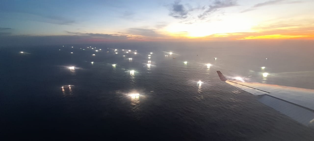
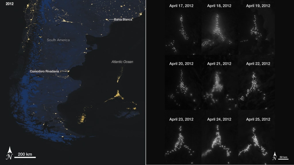
At the limit of Argentina's Exclusive Economic Zone (200 nautical miles from the coast), regulation falls away. Every season, foreign fleets, predominantly Chinese-flagged vessels, concentrate in the adjacent high-seas band to fish. Their lights are visible from space, but what happens beneath them is opaque: oversight is limited. [Sources: Global Fishing Watch; NOAA/NASA; EJF 2025]
Activity Over Time
Monthly total fishing hours show an upward trend and clear seasonal peaks. In recent years, more than half of the region's fishing hours correspond to the Chinese fleet, even when all Argentine fishing is included.
Methodology note: AIS, a radio-based automatic identification system, does not capture every vessel because of switch-offs and coverage gaps, and reception improved over time. That means it can diverge from other sources. [Sources: GFW]
Spatial Patterns and Flags
In 2024, fishing density centers on Mile 201. The country selector shows how China concentrates its effort in this high-seas band, while other flags are more dispersed.
Nighttime Satellite Observation
Not everything appears in AIS: some vessels turn off their signal. In the early hours of January 18, 2025, during a pass between 04:56:58 and 04:57:27, NASA/NOAA's SNPP satellite detected hundreds of light sources compatible with fishing vessels in the Mile 201 area using VIIRS (Visible Infrared Imaging Radiometer Suite). EOG (Earth Observation Group) classifies 283 of them as boats with high confidence. Although these data are estimates, this sensing widens the view and helps size activity that is "invisible" to AIS.
Important: VIIRS boat-detection estimates can include false positives such as clouds or other lights, and depend on conditions. They help estimate magnitude and patterns, but require careful analysis. [Source: EOG]
Operational Opacity
Here we map suspected AIS disabling events. These are estimates based on signal patterns, produced with machine-learning algorithms by Global Fishing Watch. Disabling events make oversight harder and can indicate illegal practices. Multiple reports and local records have documented illegal incursions in recent years. [Source: GFW disabling events]
Interactive Epilogue
In a 30-second loop, we show a random selection of tracks from 24 fishing vessels in the Mile 201 area between 2012 and 2024. [Source: GFW]
With this interactive visualization, we aim to reinforce the importance of monitoring and transparency around large-scale fishing, often operating at the edge of the law, as it grows along the edge of Argentina's EEZ. We also highlight the work of organizations such as Global Fishing Watch to make this problem more visible and analyzable.